When we got interested in the idea of how local food systems and airports could work together to strengthen communities and local economies, we built a GIS map to visualize how the two systems are laid out.
At first it was just for our own use, but in talking to folks we soon realized that few people who don’t work in either local foods or airports realize how extensive each system is, let alone both. Until we made this map, even we didn’t have a great idea of how they might fit together. So, here is the result…
(View the map full screen here)
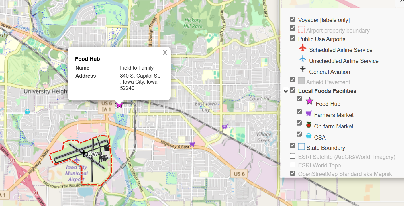
We invite you to play around with it and explore your community and region. The map includes all public use airports in the US, broken into three categories. The first two are those that have airline service. These are airports certificated by the FAA under 14 CFR Part 139. You can find out more about what that means here. The others, which make up the vast majority, are general aviation airports that do not have air carrier service. If you zoom in far enough, you will also see airport property boundaries and pavement areas.
The second set of data are from the USDA Local Food Directories. We have included Food Hubs, Farmers Markets, On-Farm Markets, and Community Supported Agriculture (CSA). More info can be found on the USDA local foods website, including searchable directories with details for each location. To keep the clutter down, only Food Hubs are turned on by default. You can get the others by checking the box in the legend.
On the map, you can get more information about any airport or local food facility by clicking on it. There are also basemaps that include topographic and satellite data provided my ESRI. These can be turned on and off from the legend when you are zoomed in. Finally, there’s a measuring tool if you want to get distances or areas from the map. It is located under the zoom in/out icon.
This map was really helpful for us to visualize and think about how these two systems fit together. We hope you find it useful, and would be happy to hear any feedback you have about the map or this idea to link up airports and local food systems. Leave us a comment below.
Data Sources
Public use airports:
US Department of Transportation Bureau of Transportation Statistics. Aviation Facilities, October 20, 2025. https://geodata.bts.gov/datasets/usdot::aviation-facilities/about
Airport property boundaries and pavement:
ESRI, TomTom North America, Inc. July 8, 2025. https://www.arcgis.com/home/item.html?id=2706fbe2d7c74b488a609938df8f9578
Local food systems facilities:
USDA Local Food Directories. Accessed December 2, 2025. https://www.usdalocalfoodportal.com/fe/datasharing/
Leave a Reply